Directions
Photos of Our Office Building
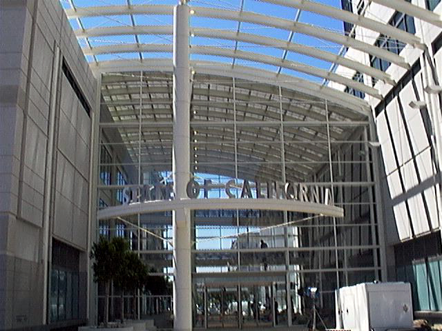
View of Entrance
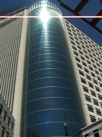
View of Building Outlook
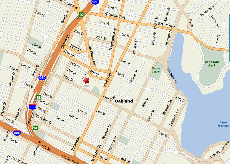
Map of Downtown Okland
Driving Directions
From San Francisco:
Distance: 8.8 miles
Approximate Travel Time: 30 minutes
| Directions | Distance |
|---|---|
| Go East on US 101 to I-80 | 0.7 miles |
| Go Northeast on I-80 (Portions toll) | 8.1 miles |
| Take the I-80 EAST ramp | 0.1 miles |
| Take the I-580 EAST exit towards HAYWARD/STOCKTON/DOWNTOWN OAKLAND/CA-24/ALAMEDA. | 0.8 miles |
| Merge onto I-580 E | 1.2 miles |
| Take the I-980 WEST exit towards DOWNTOWN OAKLAND/(I-880 S) | 0.4 miles |
| Take the I-980 WEST exit on LEFT. | 0.1 miles |
| Take the 18TH STREET exit towards 14TH STREET. | 0.2 miles |
| Turn SLIGHT LEFT onto BRUSH ST. | |
| Turn LEFT onto 17TH ST. | 0.3 miles |
| Turn RIGHT onto CLAY ST. |
From Sacramento:
Distance: 80.6 miles
Approximate Travel Time: 1 hour, 49 minutes
| Directions | Distance |
|---|---|
| Go South on I-5 to I-80 | 1.2 miles |
| Go Southwest on I-80 (Portions toll) | 76 miles |
| Merge onto I-580 E/I-80 W. | 0.4miles |
| Merge onto I-580 E. | |
| Take the I-580 EAST exit towards DOWNTOWN OAKLAND/HAYWARD | |
| Keep LEFT at the fork in the ramp. | 0.3 miles |
| Merge onto I-580 E. | 1.2 miles |
| Take the I-980 WEST exit towards DOWNTOWN OAKLAND/(I-880 S). | 0.4 miles |
| Take the I-980 WEST exit on LEFT. | 0.1 miles |
| Merge onto I-980 W. | 0.5 miles |
| Take the 18TH STREET exit towards 14TH STREET. | |
| Turn SLIGHT LEFT onto BRUSH ST. | |
| Turn LEFT onto 17TH ST. | |
| Turn RIGHT onto CLAY ST. |
From San Jose:
Distance: 49 miles
Approximate Travel Time: 1 hour, 9 minutes
| Directions | Distance |
|---|---|
| Take the I-880 NORTH ramp. | 0.2 miles |
| Merge onto I-880 N. | 38.3 miles |
| Follow the signs to get onto I-980 E. | 0.2 miles |
| Take the 11TH ST exit towards 14th St. | 0.3 miles |
| Turn SLIGHT LEFT onto CASTRO St. | 0.2 miles |
| Turn RIGHT onto 14th St. | 0.2 miles |
| Turn LEFT onto CLAY St. |
From Oakland Airport:
Distance: 9.6 miles
Approximate Travel Time: 17 minutes
| Directions | Distance |
|---|---|
| Start out going North on AIRPORT Dr. towards NEIL ARMSTRONG WY. | 0.1 miles |
| Turn RIGHT at the intersection of NEIL ARMSTRONG WY. to stay on AIRPORT DR. | 1.3 miles |
| Turn RIGHT onto HEGENBERGER RD. | 0.8 miles |
| Take the I-880 NORTH ramp. | 0.2 miles |
| Merge onto I-880 N. | 6.2 miles |
| Follow the signs to get onto I-980 E. | 0.2 miles |
| Take the 11TH ST exit towards 14th St. | 0.3 miles |
| Turn SLIGHT LEFT onto CASTRO St. | 0.2 miles |
| Turn RIGHT onto 14th St. | 0.2 miles |
| Turn LEFT onto CLAY St. | 0.1 miles |
From SF Airport:
Distance: 20.6 miles
Approximate Travel Time: 33 minutes
| Directions | Distance |
|---|---|
| Start out going Northeast on S SPRUCE AVE towards GRAND AVE. | 0.6 miles |
| Turn RIGHT onto GRAND AVE. | 0.5 miles |
| Take the US-101 NORTH ramp. | 8.2 miles |
| Merge onto US-101 N. | 7.5 miles |
| Follow the signs to get onto I-80 E. | |
| Take the I-580 EAST exit towards HAYWARD/STOCKTON/DOWNTOWN OAKLAND/CA-24/ALAMEDA | 0.8 miles |
| Merge onto I-580 E. | 1.2 miles |
| Take the I-980 WEST exit towards DOWNTOWN OAKLAND/ (I-880 S). | 0.4 miles |
| Take the I-980 WEST exit on LEFT. | 0.1 miles |
| Merge onto I-980 W. | 0.5 miles |
| Take the 18TH STREET exit towards 14TH STREET. | 0.2 miles |
| Turn SLIGHT LEFT onto BRUSH St. | 0.0 miles |
| Turn LEFT onto 17TH ST. | 0.3 miles |
| Turn RIGHT onto CLAY St. | 0.1 miles |
Public Transportation
Get off at the 12th Street-City Center station and walk through the mall of shops until you hit Clay Street. Turn right at the Federal Building and cross the street. The State Building will be right in front of you!
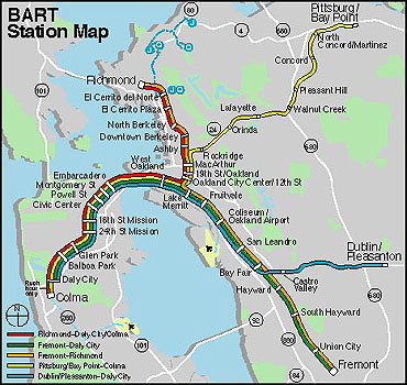
Find more about BART
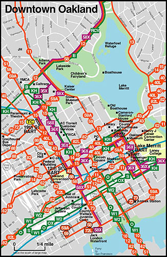
What if I take BUS?
AC Transit bus will take you around the town.
Our office is between 16th and 14th Streets and Clay Street. Look next to the Federal Building and behind City Hall!
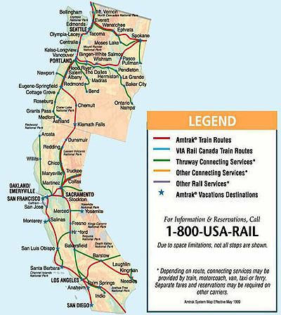
What if I take Amtrak?
Amtrak schedules vary daily.
You can find Amtrak schedules here